Introduction: The Icon of Independence
We residents of the tri-cornered area where today the states of Connecticut, New York, and Massachusetts converge, and through which the Housatonic River flows, share a marvelous heritage: We are the fortunate successors to the homeland that in the century between the 1740s and the 1840s was a strange, sparsely settled, wild yet attractive stretch of earth and water known as the 14th Colony. Encompassing parts of the Litchfield Hills, the southern Berkshires, and the ribbon of adjoining territory to the west then called the Oblong, the 14th Colony was so named and was regarded as somewhat of a separate entity from the other thirteen because it was remote, iconoclastic, and independent — beyond the effective reach of civil authorities.
Until the 1730s, the 1,000-square-mile wilderness had few permanent human residents, principally due to its spine, the twisting upper reaches of the river that the handfuls of natives who hunted near it called the Ousatunnuck. A beautiful landscape of heavy forests, misty foothills, rocky slopes, crystalline lakes, and frigid streams, it was useful to hunters for its deer and other game, but forbidding enough in winter so that they did not plant grains near its waters or otherwise attempt to settle in. Similarly, during the first century of European settlement of New England, whites were uninterested in the Housatonic Valley, having others closer to the coasts to conquer. Fairly late in the European settlement era white men finally arrived here, responding to two competing visions: of a virgin Paradise, waiting to be inhabited and farmed, and of beds of iron ore, waiting to be exploited.
Slowly settled by whites, only during the Revolutionary War did the 14th Colony reach the height of its worth to the other thirteen colonies, when its furnaces became the arsenal of the rebels, and its farms, their breadbasket.
Towards the end of its reign as the 14th Colony, the area was still very remote: Visitor Alexis de Tocqueville was amazed that he had to trek for a week to a rural backwater — Lenox — to meet one of America’s most famous artists, the Christian moralist/novelist, Catharine Sedgwick. A decade later, the telegraph and the railroads arrived in the area and put an end to isolation. But for a splendid century prior to that moment, the 14th Colony had been ungoverned and ungovernable; poor except in the quality of its people, natural resources, and faith; and self-reliant and prickly in its resistance to change: The icon of independence.
“A Hideous, Howling Wilderness”
Around 12,000 years ago, as the glaciers receded the first men and women appeared in the Valley; a granite quarry in Canaan has yielded evidence of them. But preferable as a more precise founding moment of the 14th Colony is the Battle of Big Wigwam, an event of which absolutely no traces have been found on site. Documents indicate that it took place in August of 1676, on the western bank of the Housatonic in what is now downtown Great Barrington.
It was the last battle of a faraway war. A renegade band of Narragansetts known as King Phillip’s men, after battles along the Connecticut shore of the Long Island Sound, retreated inland with the hope of losing their pursuers in the empty wilderness. In a reverse variation of the usual Indians-and-settlers story of the era, Major John Talcott’s militia tracked the renegades to the center of that wilderness, surprised them at Big Wigwam, and, in the words of an early history, “inflicted severe chastisement on them,” nearly wiping them out.
Other native peoples in the Ousatunnuck area being uninterested in combating the interlopers, the upper Valley was declared safe for colonization. But during the next fifty years, few whites rushed in. Surveying parties came and went, returning to their sponsors with negative reports: The area was too rocky and steep, with too little level land. Clearing acres for farms would require too much work. In 1694, a future president of Harvard, traveling from Boston to Albany to preach, slogged through what would later be Stockbridge and described the area as “a hideous, howling wilderness.”
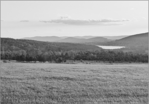
Today, by trekking up to the Native American footpath on the ridgeline above the Housatonic, which we now call the Appalachian Trail, to a vantage point near the Great Falls of Falls Village, we can still see, virtually unchanged, what eventually attracted settlers: In all directions, soft, intensely-forested, low mountain slopes, garlanded with crystalline streams, awaiting exploration.
Next week, Part II: Tendrils of Settlement, extending into the Valley from all directions.